Sailing and Wild Camping in Loch Etive
In our latest YouTube Video we take our 14ft leader sailing dinghy to Scotland. If you are interested to know more about how we planned for this trip read on.
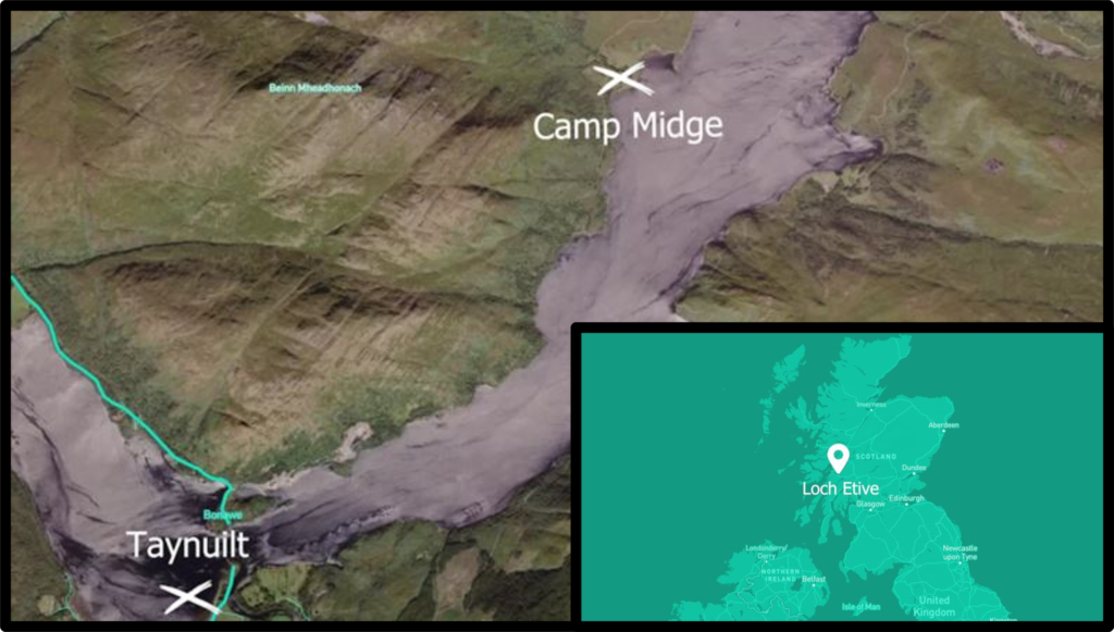
If you want to know more about the Leader dinghy and why we used this boat read my blog post ‘the leader dinghy and finding the right boat for us.’ The map below shows the area which we had our little dinghy sailing adventure in.
Planning a dinghy cruise
Once we had found the right dinghy, the plan started to come together to take it on an adventure. Where we were going to take it was to be decided. We wanted to take it to Scotland, but we were keeping an eye on the wind forecast with an open mind. Our alternate plan was the Lake District.
Cruising a leader dinghy
In planning our trip, we came across this wonderful guide by Len Wingfield about ‘cruising the leader’. This book had so many tips and experienced advice from someone with exactly the same boat. Perfect. It even said that you can sleep two people on the floor of the boat. We were’t so sure about this, and with Pete being 6 foot 2, we didn’t try and opted to pack a tent instead.
Gaining sailing experience
We are still relatively new to dinghy sailing, having started dinghy sailing in the last few years. In the run up to going on our own dinghy cruise, we have been very fortunate to find a local club at Portishead Sailing & Yacht Club, on the Severn Estuary. Without the wonderful support from the members of that club, who really have been the ones who have taught us how to sail over the last two years. I don’t think we would have had the confidence to try out this dinghy cruising sailing adventure. For another dinghy sailing adventure which was with this club, check out our trip to a huge sandbank in Severn Estuary on YouTube.
Aside from learning to dinghy sail over the last couple of years. We do have some other water-based experience which might be worth mentioning, but I don’t think you need all of this to complete such a trip. Peter has worked as a water sports instructor and guide in the past for various pursuits in the UK and also abroad (Qatar/Svalbard) sea kayaking, white water kayaking, coasteering, kitesurfing, snorkelling, and paddle boarding. I’ve (Heather) completed my RYA day skipper theory and practical, RYA marine VHF short-range certificate, RYA yacht master theory, RYA survival at sea, and an arctic survival course. We also both have first-aid experience through various courses.
Researching the cruising area
Once we decided on Loch Etive, we started reading around to see what other people had done. We came across some really good YouTube videos, one which went through the Falls of Lora on a Wayfarer. Pete was quite keen given he is used to white water kayaking. It is possible to time the tides to go through on sailing dinghy, but seeing as we didn’t have an outboard motor and there was also little wind forecast, we decided to give this adrenaline rush a miss.
I found that getting any information from a dinghy cruiser’s perspective of Loch Etive was a bit tricky. I did find a short paragraph in the Clyde Cruising Club’s guide ‘Kintyre to Ardnamurchan’ for Upper Loch Etive. The basic information that was useful for a dinghy cruiser was that the wind is fluky unless it is setting directly straight up or down the loch. Also, that you need to pass under the powerlines at the Bonawe Narrows which has a safe clearance of 13 metres at their lowest point and the greatest clearance on the north side. This wasn’t a problem on our dinghy but would be for larger vessels. Tidal streams at the narrows run at 2.5 knots springs on the flood and 1.5 knots on the ebb.
Reading elsewhere, I came across descriptions of severe squalls which can set into the Upper Loch, apparently getting worse as you sail further up into the more mountainous area. This made me quite nervous.
Navigation apps and digital charts
I downloaded Savvy Navvy which is described as like Google Maps for Boats . It’s a paid app which has nautical maps, weather, tides, and also helps you with routing. It’s not really designed for a dinghy, but it does have options for kayakers or sailing yacht, so I tried to use it as a guide with other information.
Paper charts and maps
Instead of bothering to purchase the Imray Chart C65 which has a very general map of Loch Etive at the edge of the chart. If you are on a dinghy, or a kayak get yourself the OS Explorer Map Loch Etive & Glen Orchy (377). This will be way more useful in helping you to find somewhere to camp for the night.
Weather forecasts
Before setting off, we made to sure that the weather forecast was favourable. The wind was setting along the loch perfectly so was likely to be more stable and we were not so concerned about those ‘severe squalls’. It was actually forecast to be very low at 0 – 6 mph during our cruise, almost so low we weren’t sure we’d have enough wind to sail at all. In fact, when we got out there, it was mostly perfect with a few calm zones where we needed to get out the paddles. The dinghy paddled perfectly, part sailing boat, part canoe.
Our dinghy cruising kit list
Here is our kit list, please note that you may need a different list of items and my advice would be to only use it as a guide.
- 30 metre of anchor warp & small anchor
- bailer
- full size bucket for bailing
- waterproof handheld VHF radio
- Personal Locator Beacon (one each)
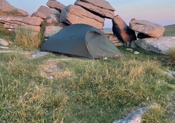
- Ordos 3 Alpkit Tent
- Lightweight sleeping bag
- Trangia cooker pans
- MSR Expedition multi-fuel stove
- Lighter/matches
- 1 litre of petrol for the stove
- First aid kit in a waterproof drum
- Spare rope
- Duct tape for emergency repairs
- Box of spare shackles, boat fittings and bungs
- Lightweight camping mat
- Sit pads
- Midge and mosquito head net (if only we had packed these!)
- Avon skin so soft (for the midges, again if only we had packed this!)
- Buoyancy aids (knife, whistle and PLB in main pocket)
- Wetsuit
- Neoprene boots
- Shore clothes – leggings, fleece, underwear, dry socks
- Shore shoes – hiking sandals or trainers
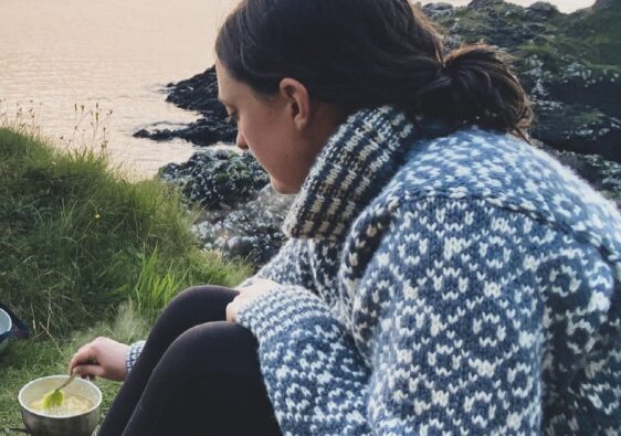
- Food and snacks – we find tinned curries are easiest and boil in the bag rice. Sachets of hot chocolate or other hot drinks
- Spork
- Knife
- Headtorch
- OS Map
- Mapping/charts app on a smart phone such as Savvy Navvy
- Whistle
- Water in 5L drums or bottles
- SPF 50
- Sunhat/woolly hat depending on when you go
- Paddles
- Fishing rod
- Sail repair tape
- Leatherman multi tool
- Mast head float*.
*We didn’t have a masthead float because we couldn’t buy one in time due to a bank holiday, but I would suggest to use one if you are dinghy sailing unsupported. We did however know that we could right our boat even when turtled and on our own if needed because we practised this on a reservoir prior to leaving for Scotland.
Happy adventures!
Heather 🙂
Please note that as an Amazon Associate I will earn a small commission from qualifying purchases if you make a purchase using the links above. I’ll be using any commission I make to invest in better equipment to continue making videos. Thanks!